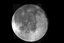
While we don’t yet have colonies on the moon, you can explore the surface of the moon from the comfort of your own home or office.
To celebrate the 40th anniversary of the Apollo 11 moon landing, Google Earth has added a new feature, Google Moon. The tool functions like Google Earth and is a 3-D atlas of the lunar surface.
After downloading the tool, users can take tours of landing sites, as narrated by Apollo astronauts, view 3D models of landed spacecraft, view panoramic images of the lunar surface, zoom into 360 degree views of astronauts’ footprints, and watch rare TV footage of Apollo missions. You can view locations of the various space debris left behind by missions to the moon since 1969.
The tool is an addition to Google Earth 5.0, and allows users to zoom on the moon in the same fashion they are able to zoom in on Earth’s streets using Google’s Street View web service.
Four different types of data have been included in Google Moon. There is visible imagery taken by the Clementine Mission, a lunar terrain map to view elevation, a collection of placemarks detailing the Apollo missions, and there are also geologic and topographic maps available for users, which were used in Mission Control for the Apollo missions.
You can check out the application here: Google Moon


Great site, but I still can’t find Mike’s property.